
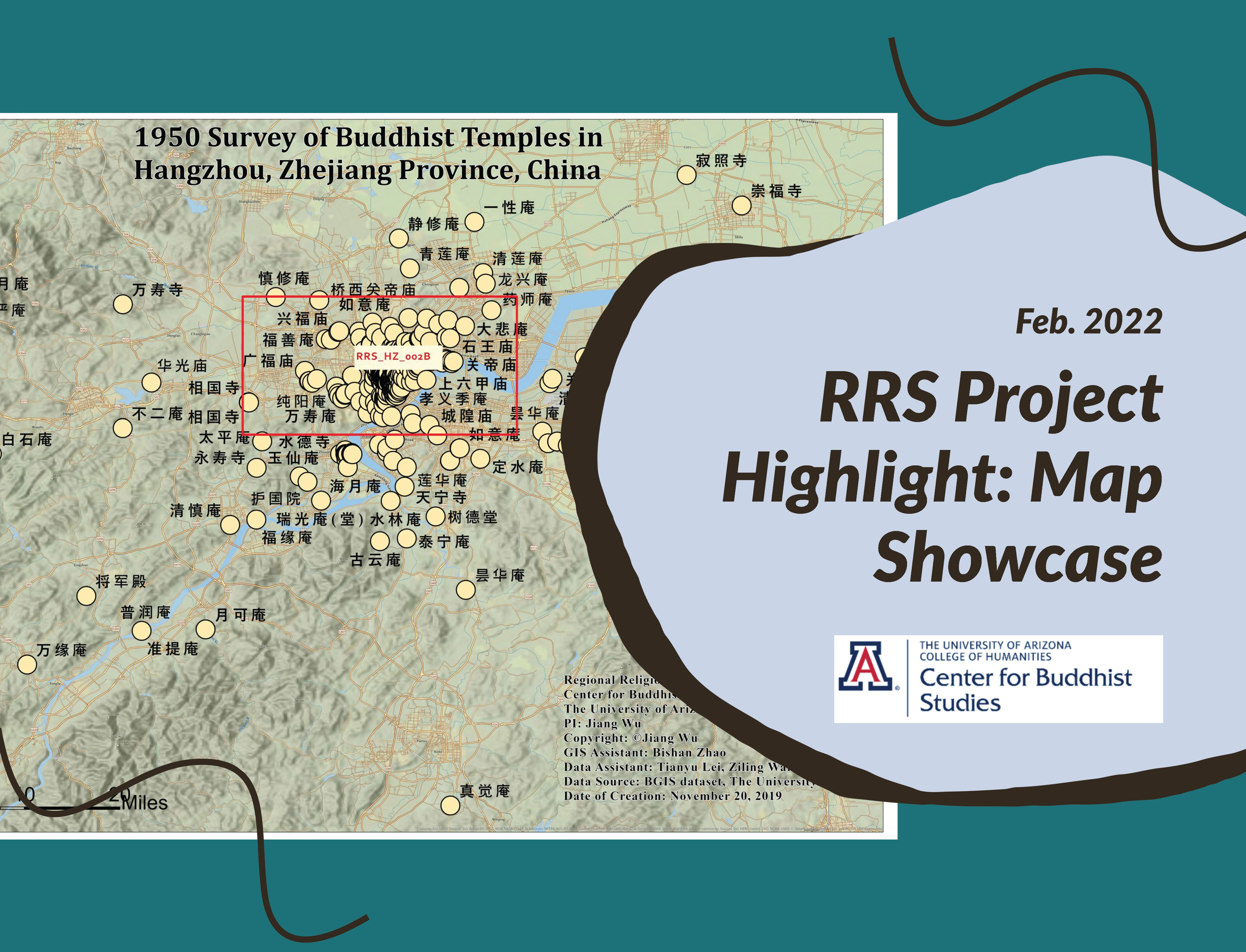
Map Title: 1950 Survey of Buddhist Temples in HangZhou, ZheJiang Province, China
Map Description:
This map is a visualization of all Buddhist temples in Hangzhou according to a 1950 survey from the BGIS dataset, and the basemap is adapted from ESRI. There are four maps in this set (indicated as 002A-D), each of them providing a closer scale to the base map to highlight the clustered temple points. If viewing this map from our website, please click the little black arrow on the right side of the map to navigate them.
Please click here to see a set of maps: https://rrs.arizona.edu/project/1950-survey-of-buddhist-temples-in-hang…
Creator:The Center for Buddhist Studies, The University of Arizona
Data Source: BGIS dataset
Creation Date: Nov 20, 2019
Map ID: RRS_HZ_002A-B-C-D
Region: Hangzhou
Religion: Buddhism
Contributor: BGIS dataset
Copyright: Jiang Wu
Principal Investigator (PI): Jiang Wu
GIS Assistant: Bishan Zhao
Data Assistant: Ziling Wan, Jeffrey Liu, Tianyu Lei
Project Information: Regional Religious System (RRS) is a new concept we developed to capture the regional and local characteristics of Chinese religion in spatial terms. Based on our BGIS data, we have experimented to define the concept and method of RRS. The concept and method developed in this project will be used in other areas and projects in the future. https://cbs.arizona.edu/regional-religious-system-rrs
Citation: Jiang Wu, "1950 Survey of Buddhist Temples in HangZhou, ZheJiang Province, China" Regional Religious System Project, map number: RRS_HZ_002A-B-C-D. The Center for Buddhist Studies, the University of Arizona, Tucson, 2020